High wildfire danger will stick around for the next few days, which is why we are calling First Alert Weather Days through Tuesday.
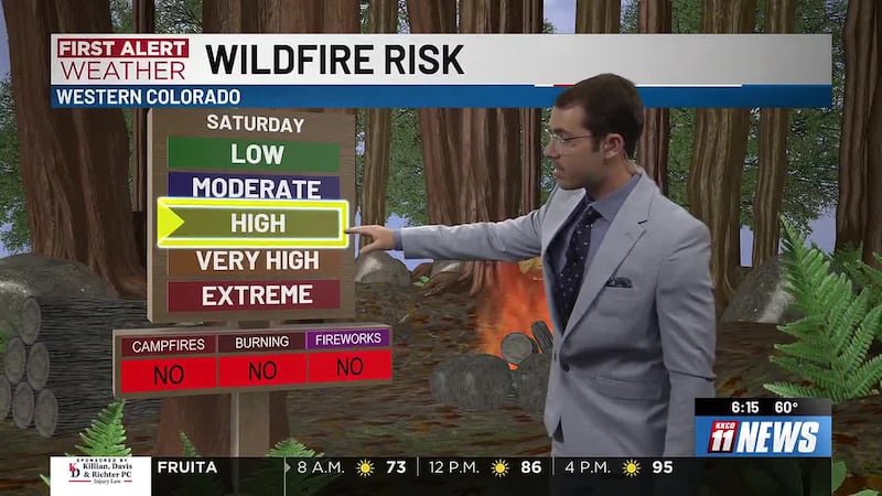
Near record high temperatures today and Saturday. Hot, dry, windy conditions will develop again Saturday, fire weather watches are currently in effect for Saturday afternoon until Saturday evening for most of Western Colorado.

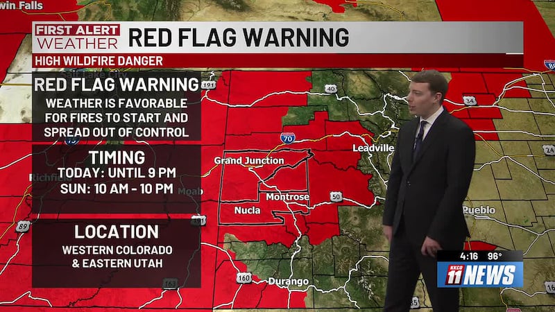
Saturday, Sunday, Monday, and Tuesday are First Alert Weather Days for a high risk of wildfires.

Red flag warnings are in effect for portions of Northwest Colorado this afternoon from 1 PM to 7 PM due to gusty winds and low relative humidity. Isolated scattered showers and storms are possible this afternoon, mainly for the San Juans. Hot, dry, windy conditions will continue again on Saturday with most likely persisting into early next week with an elevated to high fire danger for most of western slope.
New wildfires sparked in Glenwood Canyon on Thursday. Wildfire risk will be elevated for much of the next week.
Hot, dry, windy conditions will develop as temperatures trend 10 to 15° above normal for this time of year. Isolated to scattered afternoon mountain showers and thunderstorms will favor the San Juan’s and continental divide through much of this week. Critical fire weather will become more widespread Thursday and through the weekend.